
Benchmark to Roger's Pass: 300 Miles Down
Day 17: When I woke up next to the now extinguished fire, it was 35 degrees out. I spent the next hour or so pretending I couldn’t move. Eventually the sun came up over the ridge and I worked up enough motivation to throw on my down jacket and slither out of my bag. Once we all got our things packed up, Bob and Eddie gave us a lift back to the trail. I spent most of the day hiking alone, which was a nice change. I’ve never really hiked with a group before, and while I’ve been absolutely loving it, it’s always nice to get some quietude alone with my thoughts.
I broke for lunch right at the edge of a massive burn area, realizing I might not get another good shady spot for hours. You may be wondering why I cared about shade, since it was 35 degrees when I woke up. Well, at the height of the afternoon, the temperature was closer to 35 degrees Celsius – a total scorcher, over 90 Fahrenheit . A casual 60 degree F temperature shift, courtesy of the Montana mountains.
As the trail climbed up to a saddle, more and more of the landscape to the south became visible. It was clear that we were moving away from the abundance of water we’ve enjoyed since the first mile of trail. I was ready to not have wet feet all day each day but certainly not excited at the prospect of long carries between water sources.
The trail dropped down to the Dearborn River, where I found my friends parked on yet another Forest Service cabin porch cooking dinner. We’d only gone 16 or 17 miles on the day, but everyone was feeling low on energy after the late night and we elected to just crash out there. This cabin even had a pipe-fed spring on the ground – it’s hard to argue with having clean, cold water right next to you for the morning.
Day 18: When I hiked the Pacific Crest Trail, I started nearly a month after the recommended start window. I did a twenty-four mile day on my third day of hiking and from that point on only ever did less than twenty while going into or out of a town. I was afraid that I wouldn’t make it to Canada before the snows came, so I rushed. This time around, there is still the concern of snow in southern Colorado, but I don’t feel the time window constantly narrowing. I’ve been taking lots of breaks, one every five miles or so, and it’s been fantastic.
This was a day full of breaks. Toppy, Recon, Space Milk (formerly known as Aquacam…) and I stopped after a thigh-deep ford to dry our socks off and eat some lunch. Then we watched as massive thunderheads rolled in with curtains of rain in tow. We sat there at the water’s edge for over an hour, knowing that we were about to ascend well over 1000 feet and would rather be down in the valley for the storm.
Once we finally took off, rain gear and pack covers on, the rain let up. This is generally the trend. It will start pouring when your rain gear is buried at the bottom of your pack. If you put your gear on preemptively, it almost never rains and you end up drenched with sweat instead.
On the first of many switchbacks, we ran into a tall blonde kid with all the typical thru-hiking accoutrements and a massive bowie knife on his hip. We chatted him up for a few minutes; he had already gotten the basic rundown from LT and Anchor. He’s currently hiking the Great Divide Trail- which runs north from Glacier Park between Alberta and British Columbia – with the Wyoming and Montana sections of the CDT tacked on. He had intended to do a 33 mile day into Benchmark, but had gone down the wrong trail that morning and lost six hours (!!!) of hiking time to his detour. Brutal.

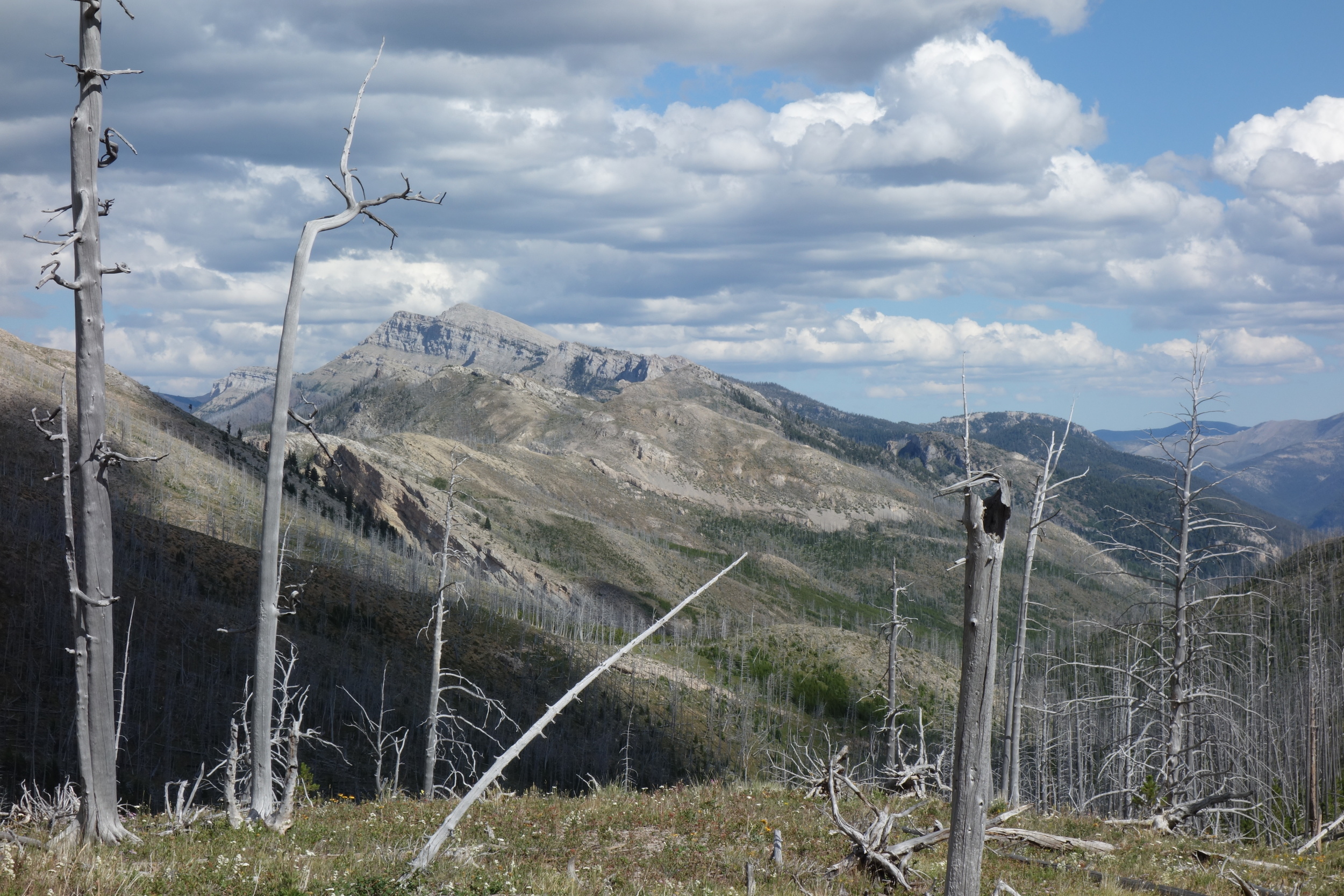
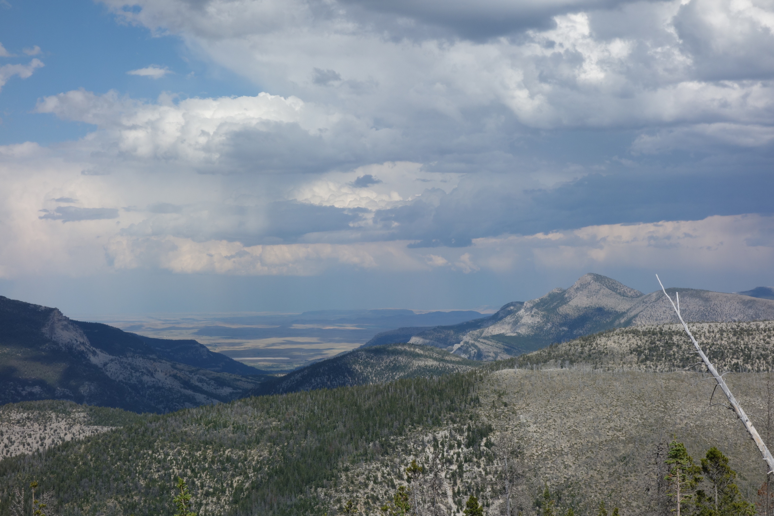
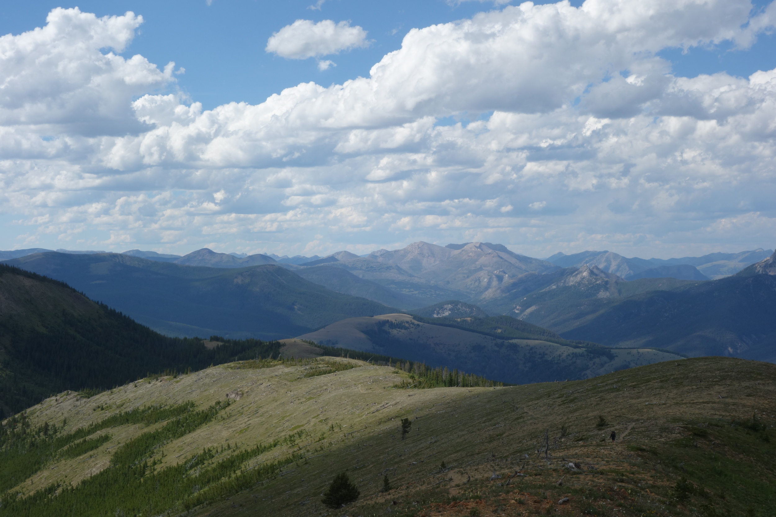
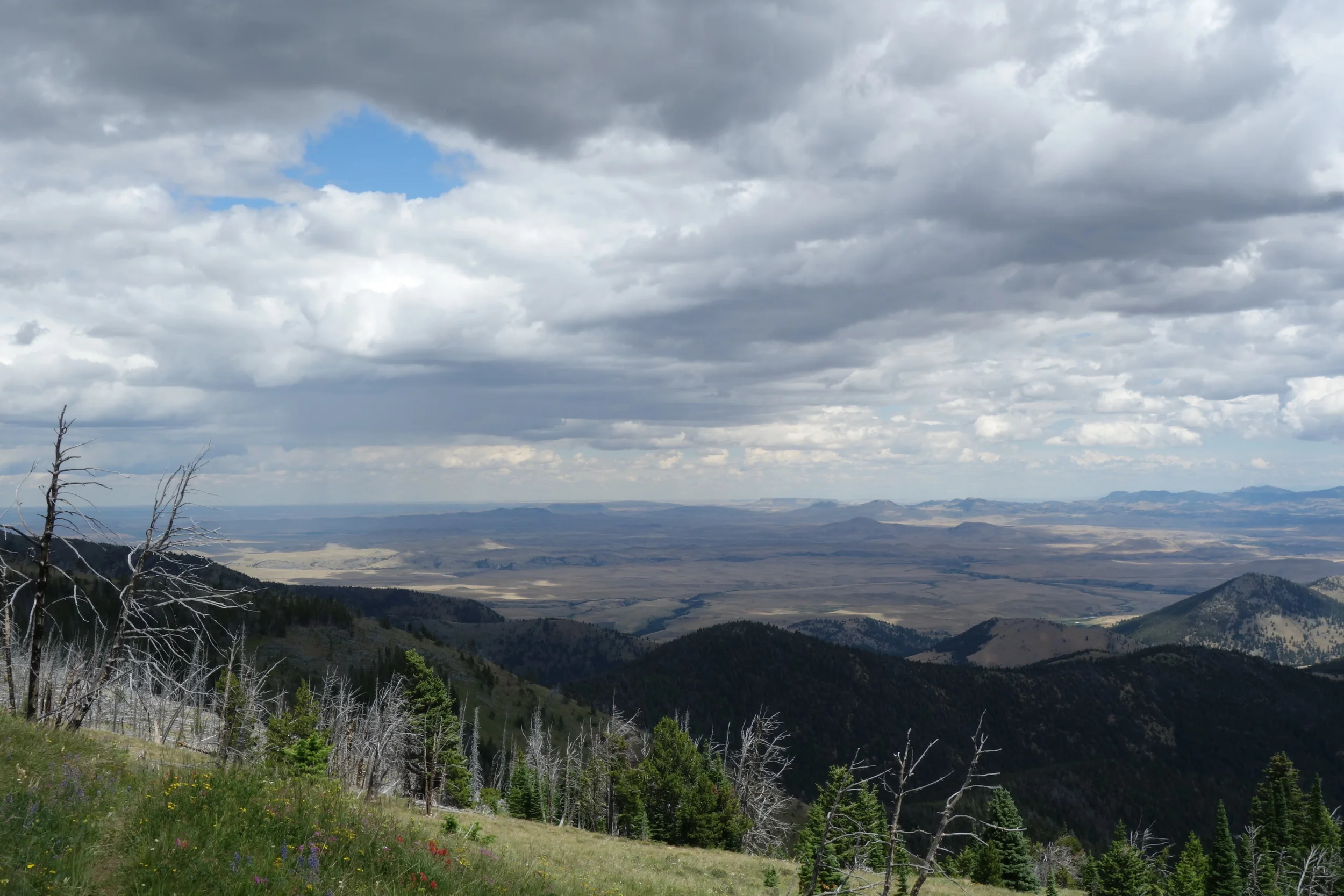
Waiting out the storm proved to be wise, as we slipped right between two storm cells on our climb. At long last, we were hiking not near, not across, but along the Continental Divide. You could see for miles and miles in every direction, with green peaks abounding in all directions but east, where you could see out to the plains. Sure looks dry out that way. I had put a fair amount of distance between myself and the rest of our crew on the climb, so when I got to the top I set up my little tripod and took some footage of the others coming up the trail. When you spend a lot of time up on mountains, you often forget just how drastic the scale of human::mountain landscape is. But when your friends look like tiny specks only a quarter mile behind you on the ridge walk, you feel like quite the speck yourself.
While the camera rolled, I put duct tape over probably 60% of my feet. Seven of my toes had hot spots, as did the sides of my heels, the balls of my feet… My shoes are starting to wear down quickly, the insoles I’ve been using have over 700 miles of hiking and trail running on them, and my feet have been wet since Glacier. My feet were basically two giant blisters in the making. Embrace the Bru-toe-lity.
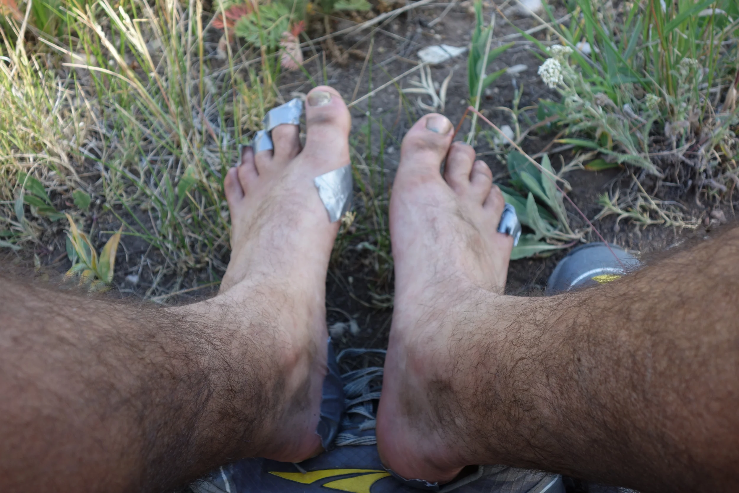
It only got worse from here, you don't want to see. Trust me.
The Continental Divide Trail has a tendency, as you may have guessed, to stick to the actual Divide whenever possible. This means a lot of what Appalachian Trail hikers call “PUDs” – pointless ups-and-downs. Obviously the best views are from atop the Divide, but sometimes you don’t want to climb 700 feet just so you can descend 900 before climbing 1000 more, especially when it would be perfectly feasible to skirt the peaks. The descent at the end of this day was warranted, though, as it drops down to the only water source around for a good while.

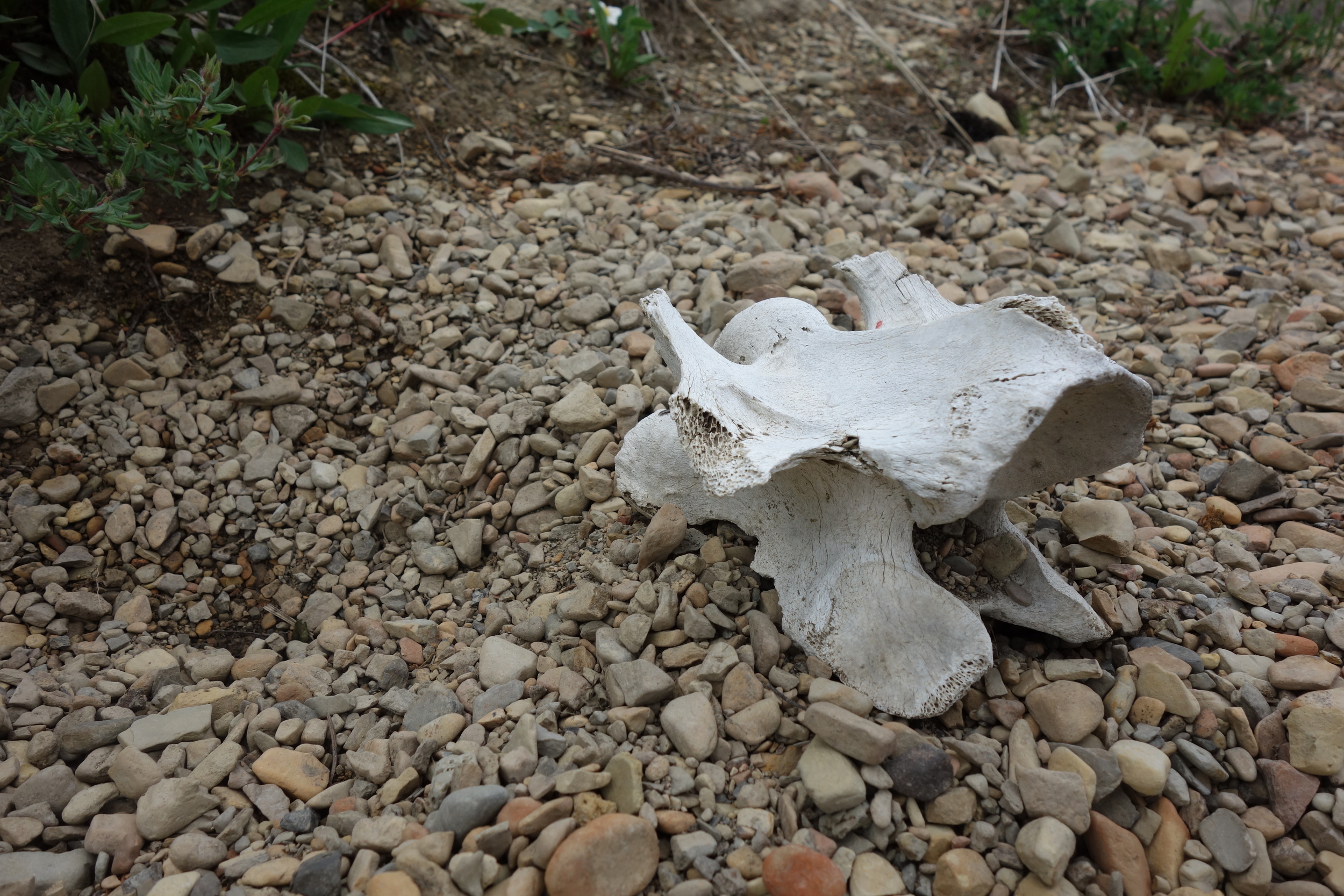
I once again got ahead of my friends, who I figure must have stopped to cook dinner. I might’ve done the same, but I was virtually out of water. When I got to the spot on the map with a note that says “Good water here, a couple hundred yards off trail,” I found a dry creek bed full of bones and a few side trails that didn’t correspond to where my map suggested the seasonal lake ought to be. I stood in the creek bed for about five minutes, looking at my map, when I heard Anchor whistle to me.
“Hey buddy, was wondering when you’d show up,” he said.
Turned out the “seasonal lake” was actually on-trail up ahead, where Anchor, LT and Matterhorn were camping. However, the “lake” was no bigger than a swimming pool at this point and full of weird red bug larvae or something. Anchor said there was decent water about a quarter mile up the dried creek bed, but that it was mosquito hell. I chose mosquitos over potential waterborne illness.
Day 18: Woke up excited about finishing a nine day, 180 mile section. Anchor, Matterhorn and LT had already broken camp. My feet were ready to rest and my stomach burned for fresh produce and French fries. Roger’s Pass lay about twenty one miles to the south, and from there I planned to bypass the trail town of Lincoln (home of the Unabomber) and spend two days in Missoula in order to interview some folks working on climate solutions. I’ll admit that it hadn’t escaped my attention that Missoula, being a college town, would have far more food options for an herbivore than Lincoln.
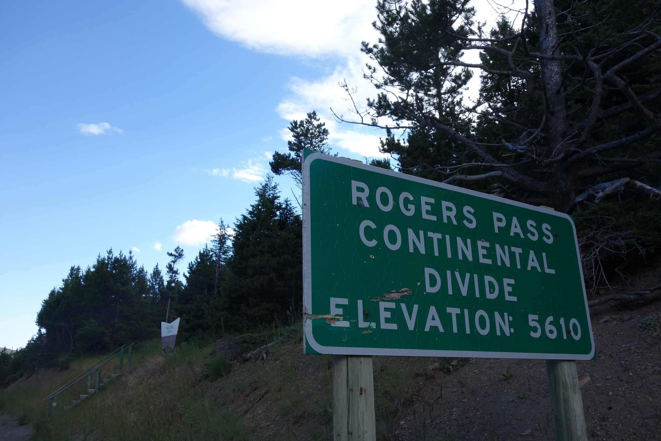
Much of the day was spent bopping around the Divide, taking in the sweeping views and pondering the liminal space between the dry, flat plains and the rugged mountains. Near Lewis and Clark Pass, we met Holden, a northbounder trying for his Triple Crown. He was pushing to catch up to his friends Jay and Lee, whom we hadn’t even seen. From the pass we climbed 1000 feet up loose skree. According to our elevation profile, we figured this would be our last real climb of the day excepting a 300 foot push to get up over the hill that hides the highway at Roger’s Pass.

Space Milk looking out to the plains
Well, this simply wasn’t true. The afternoon was spent on hillsides where the trail just disappeared for a few hundred yards at a time, as well as walking on jeep roads and climbing. We passed someone’s yurt and an old derelict ranch just before – you guessed it – climbing some more. I had caught a few glimpses of the highway already and I kept thinking that we should have already reached the pass by now, and it didn’t help that I had been skimping on food. Energy bars are (if you can believe it) even less appealing when you know there is real food in your near future.

Just as I was about to start cursing the trail for its windy, roller coaster ways, the trail ducked down into the trees and began to switchback downward. I came around a switchback and the glare of the sun reflecting off something in the trail caught my eye. “Could it be? No. It’s just a log,” I told myself. “It’s a log. In the sun. Must be burnt, such a shiny log. It’s just a… oh my god is that a box of Sprite? TRAIL MAGIC!”

The glare came off a gallon ziplock bag with a piece of cardboard and a rock (to weigh it down) inside. It said “CDT MAGIC 2016 – please take trash and rope with you when gone.” There was a twelve pack of Sprite with exactly four cans left, enough for me, Toppy, Space Milk and Recon, and then some plastic bags hung up above the trail with rope. We lowered the bags and found them full of bananas, apples and glazed “yeast rings”, which is apparently an acceptable way to refer to donuts.
We got down to the Pass and were thrilled to see a truck pull over within thirty seconds of us arriving. Immediate hitch? Good omen. Except these people hadn’t even seen us. Like the next twenty cars that pulled off to the shoulder, they were simply stopping to take selfies with the “CONTINENTAL DIVIDE” sign.
We spent nearly an hour trying to hitch down into Lincoln, a mere 18 miles away. Eventually a guy in a survey van pulled over to ask if we were alright. He agreed to give us a lift, but as the van was set up as a camper, he had to move all his stuff around so that we could fit. He told us that he was 50% German, 35% African (sic) and 15% Cherokee, and that he was surveying routes for safety for a company that transports massive power plant equipment. He told us in detail his plans to start a community completely off grid with renewables, Tesla batteries, permaculture etc.
It was quite an interesting ride. He dropped us at the convenience store in town where we wolfed down some junky snacks and waited for my friend Nicky to meet us to give us a lift into Missoula. Toppy, Recon and Space Milk couldn’t pass up on the prospect of good town food and an REI to replace faulty gear, so they joined me in my excursion.