
“3. Look out for land mines." A Compilation of my Favorite Notes from Jonathan Ley's CDT Mapset
First things first - I never listen to the Trail Show. But... the recent episode about the WASU was on in the background somewhere or something... anyway I caught them talking about hiking the CDT with Ley's maps. Ley's maps include the "Official" CDT route, as well as tons of alternates, and lots of sassy commentary. I have to say, most CDT hikers are forever indebted to Jonathan Ley for leading us along the trail... but as P.O.D. and Disco explain: "when you're out there, there's cursing." This often happens when there's a chasm between your perception of difficulty and Ley's. For example, if J-Ley says a cross-country route is "doable," there's a good chance it's a nightmarish slog that will leave you all too aware of your mortality ("DAMN YOU, J-LEY" - P.O.D., myself, most CDT hikers...) That said, his advice is almost always worth following...
These notes are all from the 2016 maps. Some are classic Ley commentary, some are particularly relevant to my hike, and some just seem to capture the experience of hiking the CDT. I certainly didn't catch all the good'uns - if you know of any that ought to be included, let me know! Leave a comment! If there are some new ones from more recent years, I want to include 'em!
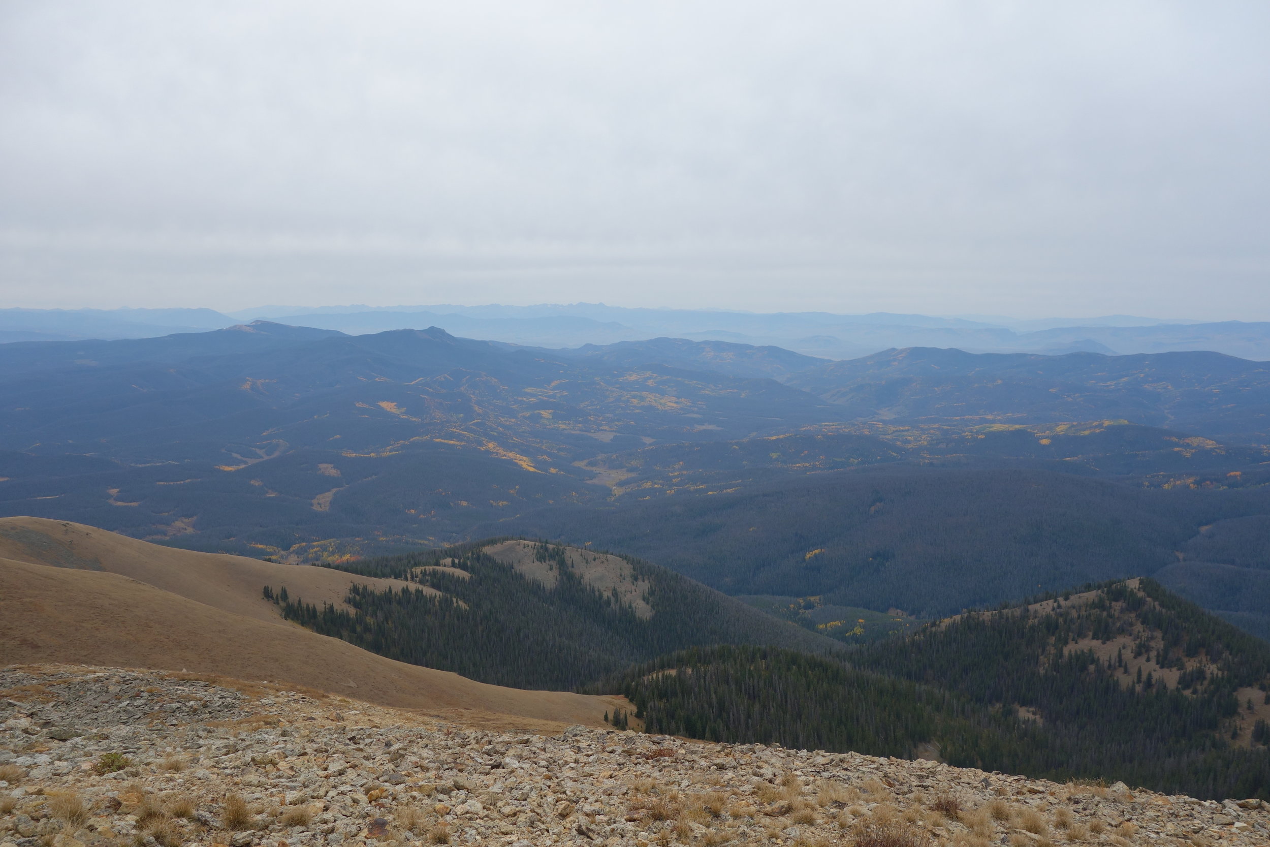
MT 3 – “1. Ahern Drift: Snow slumps down here from the cliff above and make and [sic] icy slope in the early season, about 60 degrees. The dangerous section is not long – only about 20 yards, but if you slip here with no way of stopping, you’re screwed…”

Anchor on the Ahern Drift
MT 8 – “3. SB: headed out of East Glacier, go past the first tee on the golf course behind the lodge. Head down the cart path, go left over the bridge. When you get to the top of the hill (past a road to the right that dead-ends by some houses and barking dogs), look for a small road with fluorescent markers on the trees just before a dilapidated shed. These will lead you around some private property and eventually turn into a more distinct trail. Whew.”
MT 20 – “1. … SB: this area can be a little confusing, but just bash your way forward and don’t think about it too much. You’ll find the way to go… eventually.
… 3. SB: Be sure to pay close attention to the topography here, the “path” you’ve been following disappears in a meadow.
… 6. If you’re into geology, this could be an interesting cliff.”
MT 24 – “Ted Kaczynski’s (a.k.a. The Unabomber) cabin was somewhere around here, on “Lincoln Creek Road.” Of course, the entire thing got carted off to the FBI, so there’s nothing to see.”
MT 26 – “2. This can be a confusing intersection, especially SB. Use your compass to figure out which direction to go (i.e. east). Buddha (2005) offers this SB wisdom: “You might not be on FS1852 like you think you are, chances are, you’ll be on FS708, in which case, you have to walk east, past the old cabin on the left, turn right on the actual FS 1852, then another right onto FS571.
3. Finally found water here, it was flowing (it appeared) from the unnamed gulch to the northeast. Most of the streams in the area were dry or polluted by cow sh*t.
5. Marysville has a post office, and may be a resupply option. There’s also a bar, open 5-?, wed-sun. Bottoms up!”
MT 28 – “5. SB: the red route takes a turn in a meadow – no tread… look for a CDT post to the left. But make sure it’s a CDT post – another hiker reports a misleading post..?”
MT 32-33-34 – “3. Water pump, trash cans, and bathrooms… oh my.”
MT 37 – “Pizza note: 2010 hikers report that no pizza place in Butte would deliver to Pipestone Pass. What is the world coming to?”
MT 39 – “1. This is really disgusting water, but you may have little choice but to drink it. Either direction, it’s a long way to more water.”
MT 42 – “Note: The Miller Lake / Mill Creek valley is private property, and the owners are reported to NOT be friendly, or give a hoot about thru-hikers. So, it’s up to you to get permission, or whatever…”
MT 45 – “1. The slope north of Sawed Cabin Lake is steep and rocky, but is negotiable. One can traverse around the edge of the bowl. Still, some people have reported this as “sketchy”. Anyway, there’s no debate it’s a beautiful area!” (it was sketchy. don't recommend)
MT 47 – “1. This is the old “pre-2006” route, and isn’t exactly straightforward. Follow the new trail & count your blessings.”
MT 49 – “Note: There are a bunch of passes along the divide officially known “Big Hole Pass.”
MT 51 – “2. NB: shortcut is steep on both sides, and takes about an hour. On the Slag-o-melt side, stay west of the trees. This isn’t going to save you any time… I only drew it because some people will be tempted to take it anyway.”
MT 52 – “5. Lower Miner Lakes Campground is about 2.5 miles this direction. From there, you can hitch to Jackson, MT, which is reported to be a really cool town complete with a hot-spring saloon.” pardon... DID YOU SAY HOT SPRING SALOON?!

Up on the Divide
MT 53 – “3. Reported to be a little steep, but very do-able x-ctry shortcut. One group took 2 hours to get from bottom to top… but that seems a bit excessive.”
MT 55 – “1. There is water at the Sacajawea Memorial Camp here. If you’re familiar with the Lewis & Clark expedition, you’ll understand that this is a rather famous spot, and historically renowned little stream. NB: this is last on-trail water for about 25 miles.”
MT 56 – “5. There’s a lone post in the middle of nowhere here.
Ponder it for a moment,
then ignore it and stick to the jeep road.”
MT 58 – “2. And 3. – These springs may be marginal in the early summer for a SB hike, but can turn a bit foul and mineral or algae-covered by late summer for NBers. #3 was reported in better shape in 2014, a few yards off-trail, with a log fence and the spirit of an elk on guard.”
MT 60 – “3. Cottonwood Peak is just darn cool… Do you think you’ll ever make it back here again? Better climb it now while you have the chance!”
MT 62 – “The alternate route over Nicholia/Deadman “pass” is highly recommended. It’s not really a whole lot longer than the red-line route, and you won’t regret it… What’s an extra couple hours of hiking? Why are you doing this hike in the first place anyway? Probably to visit places like this one!... Don’t wuss out!”
MT63 – “1. There is a vertical cave/shaft here with a bunch of bones in the bottom (no sign). The story I’ve heard is that in winter, this hole gets covered in snow, and for many years this created trap which unlucky bison fell into. It’s easy for a person to climb down into, but not so easy for a bison to climb out of. GPS coordinates of the cave: N44.4860278 – W112.74461
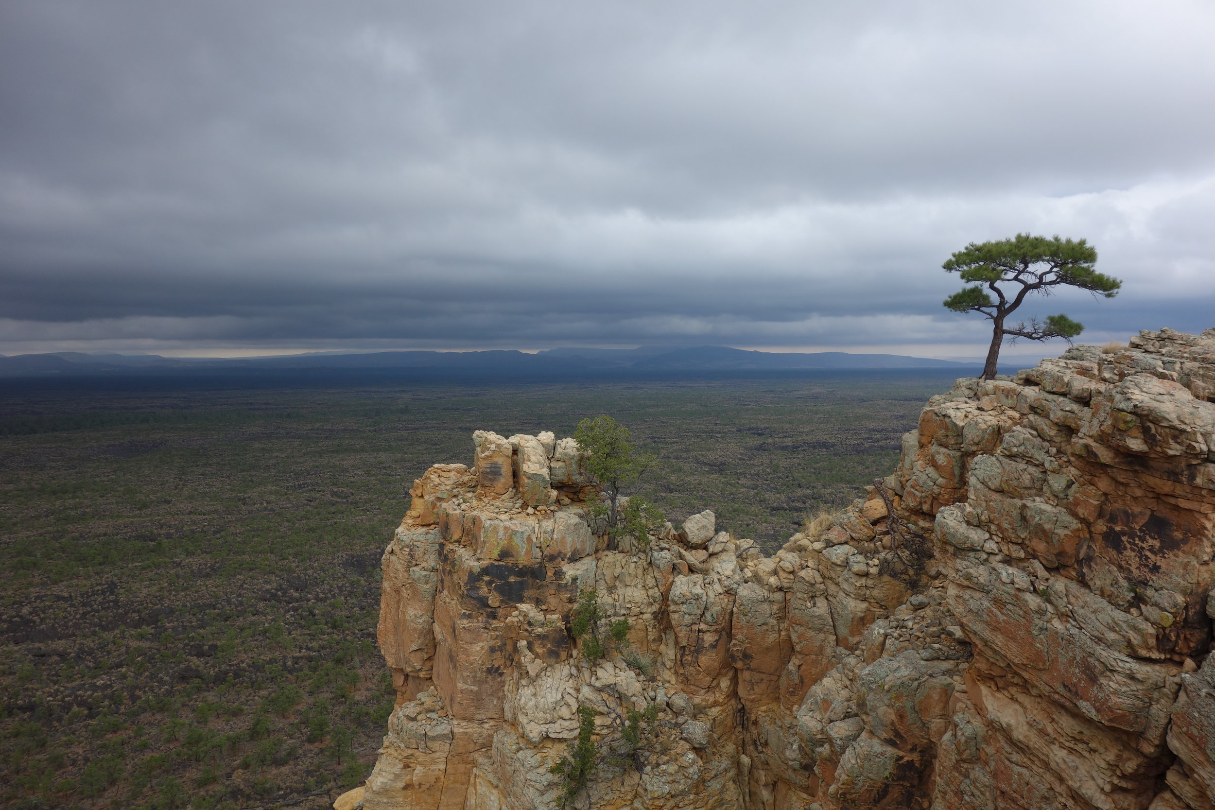
PS: Looking at 2013 google earth imagery, it appears someone is mining just west of the cave. Not sure if they’ll just destroy it in the process, but it’s possible I suppose. :-(

The bone ditch was gone. Lots of mining equipment. At least we found this view
MT 65 – “…Either direction, from this point north to Shineberger Creek is a real roller-coaster/calf-burner. Have a blast!
MT 66 – “4. There is no longer a pay phone in Monida. But, the guy who lives in the caboose might let you use his phone to call the hotel in Lima.
MT 67 – “3. New section of trail in here… should be close to what’s drawn. You should see a sign reading “E. Camas Cr.” Where the trail crosses the creek. SB: On a clear day, as you approach the creek look to the SE horizon and say “whoa”.
MT 69 – “1. There is a faded sign at the top of this hill about the “Sheep Experimental Station”. The alternate to the south will pass water only if conditions are relatively wet… and you might have to go down a way to find it.”
MT 70 – “8. This is the most remote source of the entire Missouri/Mississippi river system. Cool, eh?”
WY 2 – “1. You can find a good (ok… f-ing amazing!) place to soak here where the scalding hot water mixes with Fall Creek and Shoshone Creek. If you head off-trail here, be sure to be careful not to damage the fragile salt deposits along the hot spring edges.”
WY 3 – “1. This is usually chest-deep, but there is no real current, so it’s an easy crossing… just wet.”
WY 12c – “1. This “ice” has melted. In fact, many of the glaciers in the Wind River Mountains are much smaller than the maps show.”
WY 15 – “1. SB: The trail will disappear in the giant boulders at the bottom of the valley. Don’t despair! Look uphill to your left and see the tread pick up again. You’ll have to scramble up through the boulders to reach it. Don’t walk all the way up the bottom of the valley… I’ve seen people do that, and… oh, those poor fools.
2. The hike over Knapsack Col is really stunning, possibly one of the most amazing places along the CDT. It does require some rough scrambling east of the Col, so only do it if you’re sure-footed on off-trail terrain. The hike on the west side is fairly straightforward. On the east side, there is a bit of rapidly melting glacier. You might be able to stay completely off of it by staying to the north side on boulders. Some of these boulders maybe resting on ice, so use caution as they could shift underfoot (best to stay away from the ice’s edge). Also, take care to avoid the center of the snow slope below as there is rockfall danger. But, all-in-all, this is a very do-able route… especially for someone who just walked 1000+ miles to get here.”

Going up to Knapsack Col
WY 20 – “3. Speedo (2006) recommends climbing East Temple Peak. You basically just walk up from the pass. There is a cave you could sleep in right near the summit, and another one a little further down. There is also something called the “diving board”, where you can lay on your belly and look straight down 2,000ft! Yikes.”
WY 23 – “5. There’s a windmill here, look for white plastic pipe plug and unscrew it. Might be a challenge. Here is some advice from Ice Axe (2010): If the windmill is spinning, water will be surging through the tee every time the pump rod is on the up slide. If you have a water filter carefully put the input hose inside the tee towards the pump rod side.. just an inch or so now, if you go in too far your hose might become jammed between the pump rod and well housing. Pump away! If you do not have a filter you can carefully stuff your bandana down past the tee making sure just to leave enough sticking out so you don’t lose it down the pipe! This effectively forms a dam and water will back up out of the tee and into your waiting bottle. Replace everything when you’re done!”
“7. The trail crosses at the high point of the road. Atlantic City is about 1.3 miles north of this point along the road. There are 2 roads north of the map. Which one is the right one to Atlantic City? Let go of your hesitation, breathe fully, and follow your dreams… they will always take you to the right place.”
WY 24 – “Note: The Sweetwater River alternate is a nice break from the desert. There’s water (sweet!), shade (double sweet!), cows (moo!), a pretty canyon (view!), and a variety of mellow stream crossings.
WY 25 – “2. Spring might be nearly dry… Reported to be a layer of slime covering what is otherwise pretty good water. So, just push the slime away. Just think about this – what is tea but dirty water with a fancy name?”
WY 26 – “1. There is some probably disgusting water here. There has been an attempt to fence it off, but expect cows to be standing (and pooping) in the water. Yum. That said, the source has been reported “good” by some earlier-season hikers. This may be the best source between Benton Spring & Weasel Spring.
2. Some icky contaminated pools here, but you have to look around.
3. Poor, nasty pools below fence area.
4. Very dry.”
WY 28 – “3. Barrel with water running out of a pipe… Open top of barrel, and turn the valve to get flow. Of course – turn it off when you’re done! There is another barrel with gravel and an old pair of boots inside… that is not the correct barrel. The correct barrel might be hard to find…”
WY 44 – “3. The [CO/WY] border is marked (I’m told) only northbound. So, if you’re headed south, look over your shoulder for the proper place to whoop it up! In recent years, (2010 hikers report much whooping – be sure to partake).
CO 1 – “1. There is a confusing double-intersection here. I don’t want to confuse you more with confusing directions. Just use your noggin!”
CO 7 – “3. SB: Parkview Mountain is steep but do-able – follow the cairns to find this trail. The alternate to the north is for thunderstorm avoidance.” A hiker’s note on Guthooks said it was so steep that it ought to be avoided. Really wasn't too bad
Up on Parkview
“3. There are some seriously gnarly blowdowns along Knight Ridge, for about 3 miles. These blew down in 2010, and as of at least June 2012, were not cleared. Multiple hikers have reported that hiking through the blowdowns is a nightmare to be avoided, taking 3+ hours to navigate, and involving many cuts and scrapes…”
CO 12 – “1. Dr. Who left his tardis here…”
CO 14 – “The “trail” here is along a cliff, and requires some scrambling – using your hands, and climbing up/down rocks. Headed south, stay a little to the right of the ridgeline. There are occasional cairns, but you really have to pick your own way. SB: you can avoid the technical bit if you drop off the west side at the second “bulge”, then contour to the lower saddle. Hopefully that’ll make sense you’re looking at it all. … Any way you go, the next section to the south has a lot of up and down and is at 11,500 to 13,500ft. Don’t expect to make your usual mileage in this area. But heck… it’s really spectacular!”
CO 16 – 3. SB: When you get to this ridge, keep going past the sign. It’ll look like you have to step off a cliff. The first 10 feet or so are steep, but the switchbacks get better after that.
CO 17 – “1. Directions SB: Cross river on Buffalo Mtn Drive, Take a right on Lakeview Dr. Take a left on Aspen Drive, trailhead is on your right (reverse for NB: thgir ruoy no si daehliart evird, nepsa no tfel a ekat. Rd. weivekal no thgir a ekat, evird ntm olaffub no revir ssorc.)
CO 18 – “1. ‘Wheeler Flats’ is the Copper Mountain ski/golf megalopolis. Get yourself a hot meal!”
CO 19 – “3. Look out for land mines.”

CO 22 – “3. SB: This alternate is now marked as the CDT… at least for SB. Everyone will go this way anyway. You’d have to be nuts to walk all the way around Twin Lakes.
5. This is (was?) the “official” trail. It’s also completely ridiculous… I don’t think anyone actually hikes this.”
CO 23 – “4. There was a pretty dank emergency shelter here… may be gone by 2012”
CO 24 – “General note: So it seems the USGS is using red lines to denote “boundaries” on some maps… that’s kind of confusing – hopefully you can figure out which red lines are the trail. I guess I should have picked a different color to draw the trail! Well, too late now.”
CO29 – “General Note: Much of the trail in this area has a lot of rocks. It makes for frustrating progress… Everyone else hiked through it, you can too!”
CO37 – “6. Source of the Rio Grande! Have yourself a drink, because it’s about the only part of the Rio Grande that’s clean enough to drink.
8. There is an emergency shelter here at the point marked 8. If you see some smelly hiker handing out snickers, that would be Lint… say hello. The official route goes here… but the other routes are cooler, especially if you can stomach Hunchback Peak.”
NM2 – “6. There’s a bit of PUD here. So it goes…”
NM4 – “6. Bit of the trail may disappear in a bog here.”
NM6 – “1. Water is god… I mean good.
6. These alternates were suggested by a local (especially the northern one).. Look for “Upper Camp Road”. Note the turn at the center of grid 21. SB: Pay attention to the topography near where they reconnect with the red route on the south end. You have to briefly walk out of the canyon bottom… avoiding some cliffs.
NM8 – “Skull bridge! Spooky, eh?”
NM9 – “General note: Be careful of sketchy individuals at trailheads along hwy 96… drug deals, etc….”
NM11 – “1. A combo Forest Service & BLM office is located here. Drop by… say “hello”... do a little impromptu CDT PR.”
NM12 – “1. The spring at the end of the arroyo here is a mud puddle.
2. There are roads all over the place in here (and nervous land owners) Ojo Jarido is a pool of water fenced-off from the cows… pretty good water.
3. The canyon here is amazing, but there are steep sections with unstable soil – not for the squeamish. This alternate was drawn before the nice “main trail” was constructed to the east.
9. Good water reported here… though the USGS maps labels it as “polluted”… One hiker (Bob E) checked with the BLM office about this note… They asked everyone they could think of, even the archeologist, but nobody knows why this was marked as such. So, drink up, I guess.”
NM13 – “5. There’s a hole in the sandstone here that will hold rainwater.”
NM14 – “3. The ghost town of Cabezon was once a neat thing, but apparently is now private property. Bummer”
NM14a – “Note: There’s a report of quicksand somewhere on this map (mostly in the springtime). I won’t say where exactly, because that kind of thing is a lot more exciting to discover by accident. Ahhhh! Quicksand!!!”
NM15 – “2. Report of dead cows in this tank – Yuk!”
NM19 – “…there may be some hesitance to designate an “official trail” over the summit of Mt. Taylor, as the natives consider it sacred. I think a better way to honor that would be to officially rename the mountain Tsoodzil, the Navajo name for it (or the Zuni or Acoma names…). Anyway, enough politics, hike on!”
NM20b – “1. …The CDT route to the south of here (paralleling the road) is cairns over lava…
NM20d – “2. There’s stock tank here but you can access the valve box to get some fresh-ish water. It’s a bit of a puzzle, but hopefully by this point, you’ll be resourceful enough to solve it.”
NM23 – “3. This is long dead.
5. There is a picnic area here, but no water. South of here along the road, there has been reports of drug smuggling activity. Specifically, someone flies a plane overhead, drops a package, and someone else dries by and picks it up. Of course, it’s possible this activity will move on to some other location now that it’s more common knowledge, but who knows… It’s probably best to not camp in this area, just speed on through.”
NM24 – “2. 1200AD pueblo stone house, added-onto in the early 1400s. Some petroglyphs on the large rock just east.
3. There was water here, but YUK! Dead cows reported here…
5. Dittert site Anasazi mounds dated 1200AD. There may be pieces of pottery scattered… please don’t disturb.
7. SB: take the right turn down the road less traveled. Actually, that’s good advice for life in general.”
NM28 – “2. An old alternate here cut through private property. They’re reported to be real jerks, and will call the cops on you, etc. Bottom line is: don’t go this way…
NM29 – “5. Water here by a cabin, covered by an iron lid. N33.81689 W 108.47684. Reported at different times as good, oily, or bone dry.”
NM30 – “2. Fenced spring on the hill. Reported to have 3 dead squirrels in bottom of tank in 2010. 3 squirrel skeletons in 2011, and a dead bear in 2012… also dry in fall 2012. You might find surface water further south in Cox Canyon.”
NM30d – “3. Reports of running water in these locations in springtime. If you’re really thirsty, you could try to keep going down Wahoo Canyon. Be sure to yell your best Wahoo! if you fill up. No – Louder! Feels good, eh?”
NM30h – “4. Tread in this area can get overgrown at times, just keep going through the thorns!”
NM30i – “4. Rabid foxes.”
NM31 – “1. SB: don’t take the far left better road, take the less-used road, which I think is FS652. If you head west here, it will go past the Negrito Fire Base, which features the famous “functional pay phone in the middle of nowhere”.
NM33 – “3. 85 crossings of the Gila River between here & Snow Lake.”
NM39a – “1. Windmill here, but well powered by solar panel with spigot with good water under the windmill. (There’s also a tank with green/orange sludge. Mmm… green/orange sludge.)”

If you squint, you can tell that there's a dead skunk floating in the water :)
NM39g – “3. Water in old tire… would you drink water from an old tire? Maybe… would you still if there was a dead, bloated Javalina in it? (reported 2012). Might be dry anyway…”
NM40a – “1. There should be an electric pump on a timer here that feeds an earthen tank. But, this might come as a shock. Really… the water is electrified (2011). Not sure if this is on purpose or accident. Just use your zen powers and fill the bottle without touching the water. Or, use the cow pond.”
NM41 – “1. I went up Big Hatchet Peak via this canyon. It was covered in thick prickly pants, and cliffs… I wouldn’t recommend it.
3. Congratulations! (SB) o Bueno Suerte (NB)
5. cRaZy CoOk!!!
6. (where a purple alternate extends south into Mexico) SB: Tempting, eh? Bueno Suerte!”
So there you have it! Happy to keep this list alive, adding and pruning as needed.