Smoke, Snow and Solitude (sort of): Anaconda-Pintler Wilderness to Darby, MT
Day 35: The "trail" runs right through the town of Anaconda and continues west on highway 1 for a while before turning onto a dirt road. Eventually I reached a single track that quickly gave way to game trails. After passing Twin Lakes, it was a hot, overgrown bushwhack. I would find well-beaten tread and then lose it every few minutes. It was pretty frustrating, and I felt down for a few miles. I tried to pull myself out of my head but it can be difficult to be present and appreciative during cross country navigating - you have to devote so much bandwidth to the task at hand. Also when you're walking into huge spiderwebs every five feet.

Welcome to House Slytherin - you will now be consumed by an enormous snake
The long, graded climb ended at Storm Lake Pass. I could finally see the Pintler Mountains I would be hiking through the next few days and my mood completely flipped. I made my way down trail a ways toward Storm Lake and was pretty shocked to see a couple with an ATV. I looked at the notes on my map and found that I was about to walk through a popular campground.

I tried to keep a low profile and pass through without getting caught in conversation with any car campers. Talking to glampers or day walkers often yields good stories and soda or other treats but inescapably involves answering the same questions as always about thru hiking. I made it to the very last campsite under the radar when a man called out to me and his dog came sprinting up.
I didn’t really feel like talking but when he found out I was thru hiking he offered me a local IPA and I couldn’t turn him down. He had a big lifted pickup truck, a dirtbike, trucker hat and such: basically the Montana starter pack. Turns out while his family is from Butte, he actually grew up in Venice, CA, not ten miles from my alma mater. We somehow ended up talking about the pitfalls of large scale industrial agriculture, unions, wildfire patterns, veganism and surfing on the Oregon coast. He took down my info with the hope of catching me again in Colorado with a cooler full of beer - I'm hoping it works out!
I hiked a few miles as the sun set to get myself into the Anaconda-Pintler wilderness

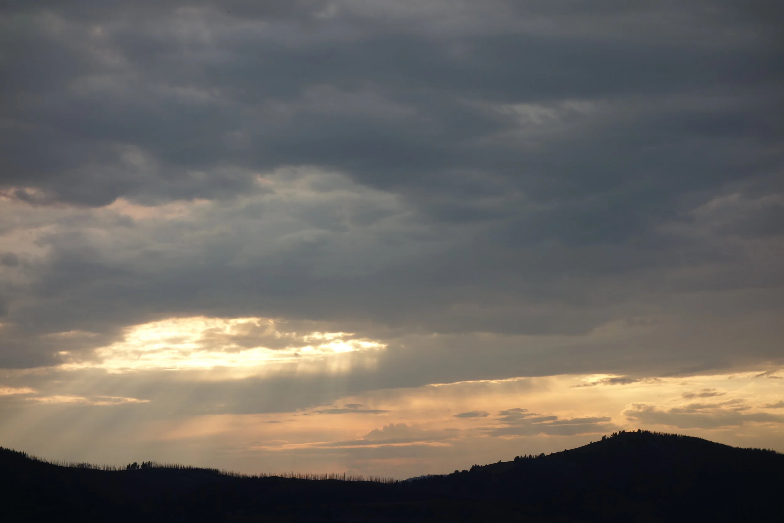
Storm Lake
Day 36: Holy moly coldest morning on trail yet. I think I stayed in my tent til 8:30. After a little climb up a pass I reached Goat Flat, elev. 9500, where the Anaconda Route rejoins the CDT. My friends had left me a note; they were only about half a day ahead of me.

Up on Goat Flat I found a little patch of snow and couldn’t resist a baby glissade. I also got my first visual of wildfire smoke coming from the Roaring Lion fire that had been claiming homes and pushing people out of Hamilton, MT due west of my location. It's always unsettling to see smoke on trail, as the best you can do is monitor the wind, pay attention to drainages and bail out routes, and keep your fingers crossed.

I went up and over Cutaway Pass only to climb back up to Warren Lake. The smoke had settled so much here that I could hardly see the mountains on the other side of the water (and this isn't Lake Tahoe we're talking about). I didn't dawdle long, as I figured the quicker I moved the better my odds of finishing this section without filling my lungs with smoke. On the next downhill, I ran into a NoBo hiker named Zippy Morocco. Zippy had a very tiny pack and the same shoes as me, Altra Superior 2.0s, which I'd never seen another hiker wear. His looked a little better off than mine; fortunately, I had a new pair of kicks waiting in Darby for me. We exchanged info about water sources, good and bad sections ahead, etc. and parted ways.

I called it a day at Rainbow Lake, which is nestled up against a few peaks and Rainbow Pass. There were a few groups of backpackers camped along other parts of the shore - one campsite even had a fire - but I was too tired to go meet new people so I just set my tent up and conked out.

Rainbow Lake in the morning
Day 37: I woke up to frost covering all the gear I hadn't brought into my tent that night. So much for my plan to jump in the lake to wake up. Fortunately I had slept with my Sawyer Squeeze filter so it hadn't frozen; the one pitfall of the Squeeze is that if it freezes, it is no longer useful in any capacity. After I warmed myself up I flew up the pass and got to Johnson lake, where the "Northern Montana" section ends and the "Southern Montana/Idaho" section begins, according to my maps.

Maybe it was the thought of having completed the first of five sections that boosted my confidence, I'll never know, but I reached a route split and opted to take my first truly cross-country route. Ley had added a note to the effect of: "Some people report this as 'sketchy', but it's certainly a beautiful area!" The alternate went around West Pintler Peak, shaved off about a half mile and avoided an unnecessary drop of a thousand feet. The beginning was great - nice tread and well-marked trail up to Oreamnos Lake. I broke for lunch here and ended up taking more time than usual, as I figured I was saving time by hiking this way.

Oreamnos Lake
After lunch, the trail disappeared. I bushwhacked up a steep creek bed onto an even steeper slope covered with bear grass. Now, my shoes had no tread left to speak of, so when I'd step on bear grass, I'd slip and fall hard. Lovely. On top of this, I did a less than perfect job of following the route my map plotted and ended up crossing a ridge at the wrong saddle, so I had to traverse one skree field to get to another that actually extended to the valley below. Sometimes skree and talus hold really well and you can simply hop from rock to rock; this was not one of those times. I was pretty nervous as I slowly worked myself down toward Sawed Cabin Lake. I was furious with myself for having chosen this stupid route in the first place.

Okay, you're pretty, whatever; just get me down from here!
When I finally rejoined the regular trail I felt like dropping to my knees and kissing the dirt like a shipwrecked sailor. I was dismayed but not at all surprised to find I had actually lost time by taking the cross-country route.
I spent the afternoon lost in my thoughts. I thought a lot about our changing climate and what the future will look like if we don’t enact sweeping systemic change as soon as possible. This is a pretty easy way to bring yourself down. I stopped at a creek to fill up water and ended up sitting there for nearly an hour, thinking about a lecture I once listened to about Kierkegaard on the essential quality of beauty, or rather the lack thereof. Once I refocused on considering the beauty in every manifestation of matter, my mood improved. I knew there was a spring coming up in a few miles and decided that’d be my endpoint, despite being four miles short of my target.

As I got near the spring, I entered a burn scar. Great. When I finally got there, after eight at night, I couldn’t find water anywhere. I turned my phone on, which had a measly 7% battery left that I had intentionally been conserving, and opened up the water report. Half Mile, of Pacific Crest Trail fame, had noted that this water source was completely dry. Guess it was finally time to do some night hiking.

I sang for the last four miles. Of course I had to hike through a burn scar. The sunset was gorgeous, though I could only see the colors playing off the clouds in the southeastern sky while I climbed up out of the saddle. I could tell it'd been a long time since I'd really night hiked - solo, at that - because I was hyper-conscious of noises in the brush.
The last half mile before the creek was full of good spots to pitch a tent. I ought to have gone back; instead I found a slopey little nook right by the creek atop vegetation (bad LNT) that didn't seem under immediate threat of dead trees falling onto it.
I cooked dinner and set up my sleep system and looked out to the meadow through which the creek runs. Wow, the clouds must have just parted to reveal the moon, I thought. I then realized I was looking at a headlamp beam. At this hour! What a coincidence.
His name was Knots - probably because of the dreadlocks that reached down to his waist. A true NoBo, he had gone through the San Juans and was trying to get all the way to Banff, Canada by September 20: huge miles every day.
We did the typical hiker exchange of info and he finally took off around 11:20.
Day 38: I had set my rain fly up partially for warmth and to shield from condensation, but also because I had every intention of sleeping in. I succeeded, despite the least comfortable campsite of this hike so far, by far. I filled up water and ate a no-cook breakfast while hiking; I didn't start until nearly ten…
I passed another NoBo, Milk Jug, who uses a half gallon jug for water, which he wears on his hip belt. That was about four miles in, just before the burn began.
I intended to get all the way to Chief Joseph Pass that night and possibly hitch a ride into Darby, where my friends would be hanging out taking a zero day, so I hiked virtually non-stop to make the 28 miles before dark. One of the only breaks I took was at Shultz Saddle, which hosted the last water source between me and the highway. I cooked my last dinner here so I wouldn’t have to carry any more water than I needed.

Jungle Gym. It went on like this for over a mile
I was hindered by countless downed trees that had fallen perfectly across the trail, but made up some time in the late afternoon when the trial widened into a Forest Service road and cross-country ski trails. At one point the trail crosses Gibbons Pass, named after the Colonel who hunted down the band of Nez Perce fleeing to Canada; the trail then joins the Nez Perce Historic Trail. If you don't know the story of Chief Joseph and the Nee-Me-Poo, I suggest you read up on it.

I could see the sun getting low in the sky and realized I would get in just shy of 10pm, right at last light. I took a jeep road down to Lost Trail Pass in order to save time, but by the time I reached the gravel parking lot I was met by the high beams of cars flying south toward Salmon, ID. No one seemed to be going my way, let alone willing to pick up a stranger in the dark.

There was a rest stop here where I could get water and charge my phone, so I hung out a bit and let my friends know I would be in town first thing in the morning. I considered camping on the grass at the rest stop but the street lights and the thought of travelers watching me sleep seemed less than appealing; I went back across the road to camp on the gravel and hitched into Darby early in the AM.